
Maps make excellent visuals and can add so much relevance to presentations that speak about anything to do with geography. You may want to show the location of company offices, franchisees or service centers.

Related Posts
 Carles Enric Lopez is CEO of Netmaps, SA, a Barcelona, Spain-based company. He has a degree in Geography from the Universidad de Barcelona (UB) and th...
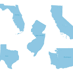 Digital Vector Maps provides several hundred maps on their site. Most maps are available in Adobe Illustrator and PDF format; so, you'll need to resav...
 PowerPoint has become a standard tool for sharing ideas, but the way we use it continues to evolve. This page brings together books that look beyond s...
 In today's video, we will look at a scenario where you have a company logo placed in your PowerPoint presentation. This logo shows up on all sides. In...